
Viking Way at 50
The Viking Way is celebrating a golden milestone in 2026 and walkers are being invited to share their memories from along the 149-mile route.
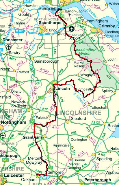
The long-distance trail runs from the Humber Bridge in North Lincolnshire through the Wolds wending its way to Lincoln and on to finish at Oakham in Rutland. It was officially opened at Tealby on September 5, 1976, by Lincolnshire County Council.
The route gets its name from the Danish and Norse settlers who occupied much of the area during the 9th Century and it takes in the towns and villages that still retain the Viking influence in their names – ending in ‘by’ or ‘thorpe’.
Walkers can either test themselves on the whole route or take in sections of it – marked by yellow signs showing a Viking helmet – and the county council is inviting some of the thousands of people who have used the footpath over the years to share their memories to mark its 50th anniversary.
“What you’ve done doesn’t have to be anything massive, it just has to be a special memory to you that you’d be happy to share,” said a spokesperson.
“A reason for walking when and where you did, something beautiful you found en–route or an anniversary of your own making. As long as you found it memorable, then we’d love to include it in the story of the Viking Way at 50.”
To jog people’s memories of the Way in the Lincoln area…it runs through Stixwould, Southrey, Bardney, Stainfield, before reaching Fiskerton where it follows the south side of the River Witham towards Lincoln. The route used to run alongside the river on Waterside South and then down Canwick Road, but was diverted in around 2002 to take a detour near Washingborough over the river.
All Lincoln residents and visitors must have stepped on The Viking Way at some point as it enters the city on Crofton Road, skirts around Lincoln County Hospital on to Lindum Terrace, Pottergate and the grounds of Lincoln Cathedral before heading down Steep Hill and High Street. It follows Tentecroft Street then down Sincil Bank towards the LNER Stadium before heading down Scorer Street towards South Park and onto Canwick Road, along South Common going up the Hill to Bracebridge Heath, Waddington, Harmston, Coleby, Boothby Graffoe, Navenby and Wellingore.
Submit your stories and photos via www.letstalk.lincolnshire.gov.uk/vikingway50